take a hike! hell's hole
- the deets:
- Trail T219
- access trailhead for TT5574 via Westside Road (also called 90, also called A-061), accessed out of High Rolls just uphill from the High Rolls Convenience Store
- plenty of parking at the TT5574 trailhead
- about a 30 minute drive from the cabin to the TT5574 trailhead via well-maintained gravel road
- not difficult
- old mining road for most of trail
- downhill to end, uphill back, no loop
- about two miles round trip
- views are spectacular and get better throughout the trail to the end
- after the "road" ends, keep walking until the end of the ridge; can see White Sands at the end
- old mine near the end of the "driveable" trail to the west of the hill
- I hiked on May 27, 2024
- temp = ~82 F
- sunny
- despite holiday weekend (Memorial Day) no one on trail; did come across three horseback riders.
- could be hot during summer mid-day, little shade (located halfway between Cloudcroft and Alamogordo). The trails are just below the tree lower fir tree line.
- good phone and data access on the trail (I could see communication towers on an opposite ridge)
The trail guide hooked me on the Hell's Hole Trail with the statement that the trial opens up to "one of the most scenic areas of Lincoln National Forest." About a 30-minute drive from the cabin, the trail is about at the elevation of High Rolls, about 7,000 to 7,200 feet. A large staging area at the trailhead for TT5574 offers lots of parking deep away from the main road. The trail is pretty decent, as it used to be an old mining road, and appears to host ATVs during busy times. TT5574 takes you to a mega-intersection of three different paths: take the one on the left, which is T219, the trail to Hell's Hole.
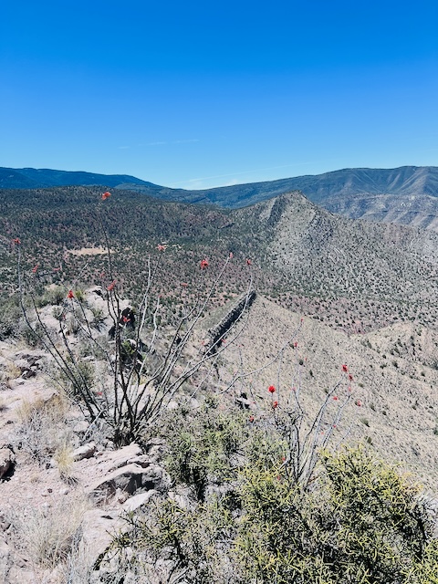
ATVs have descended this rougher road (although they are not supposed to) that hairpins to a circular "parking area" clearing. If you keep heading south along the ridge, you'll find what appear to be braided trails heading down the ridge. If you keep going until the topography begins diving precipitiously, you will be rewarded with amazing views of Hell's Hole (to the West) and White Sands through a window out of Caballero Canyon. When I was there, the ocotillos (my favorite plant) were blooming beautifully, providing a gorgeous foreground to photos. Be careful of cliff edges as there's something of a 300 to 500 foot shear cliff to the south side of the ridge.
On the hike back, once at the circular staging area, note a "road" to the left. If you follow it a short distance, you'll find a notch in the cliff that hosts two old mine entrances, one of which is collapsed and the other appears to be ready to at any moment.
According to old USGS maps, this was the Warnock Mine (so named on a ~1950 map of the area). Warnock Mine was a lead mine, but also mined copper, silver, vanadium, zinc, and cobalt. I found various remants of what appeared to be copper ore (the telltale green color). The mine operated from 1916 to 1956 and had several thousand feet of passages.
Be careful around the mine and any cliff in the area. The disposal of fracking and flow-back fluids in the Permian Basin results in earthquakes felt all the way up here, so approach with high caution. And it goes without saying to not enter any mine.
circular staging area


Comments
Post a Comment