Posts

Showing posts with the label hiking

take a hike! pumphouse ridge 1 trail

Image
  Pumphouse Ridge is just south and southwest of Cloudcroft. An old logging road runs along the ridge, and there are five trails off the ridge. I chose this trail after a long day of remote working as a quick little, nearby hike with four additional hikes to try. Boy, was I wrong! You access the trails via a five-mile jaunt down Pumphouse Canyon Road. However, that road is a little rough, and it took me just over 30 minutes to drive on it to my hike, Pumphouse Ridge 1 Trail (page 94 of the trail guide). You'll definitely want, at a minimum, an SUV or a rental car. My Model Y Tesla mad it fine, but it was slow going due to consistent patches of rough road where the underlying geology formed the road base. Although this hike wasn't spectacular, what made it special was that there was no-one out here, and no road noises or any other noises. Cell coverage was essentially non-existent with small pockets of SOS service. I was alone and became concerned that if I was bei...
take a hike! osha

Image
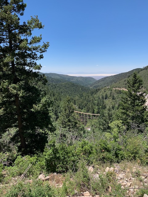
    No, Osha does not stand for the Occupational Safety and Health Administration (aka OSHA). Osha is named Osha for the Oshá (oh-SHAW) herb ( Ligusticum porteri ) that grows along the trail. Close to Cloudcroft (you can walk to it) with ample parking at the trailhead and a stunning overview of the trestle and White Sands, this 2.1 mile loop trail is one of the most popular trails in the area.   There are benches along the way but no water or restrooms (although if you are desparate, you can sneak over into Pines Campground about halfway through).     

take a hike! la pasada encantada

Image
This is an easy, well-maintained trail south of Cloudcroft that is 0.4 miles in length with little elevation difference (although the elevation of the trail iteself is about 9,000 feet). Named La Pasada Encantada (The Enchanted Past), the unique thing about this trail is that it is sight-impaired friendly with Braille signage, clearly marked trails, and texture changes in the footing to mark guide posts. There are also interactive spots on the trail for folks to feel things and get a sense of scale. Parking is ample, there it plenty of seating along the way, and a number of picnic tables if you are looking to pack a snack. The trail follows, in part, an old logging railroad spur.                                  

take a hike! switchback

Image
deets: 4.2 miles (+0.4 if you hike the spur) at 7,700 to 8,200 feet of elevation with 500-feet of elevation change moderate difficulty vistas, valleys, a bridge, a tunnel, a railroad switchback interpretive signs   The Switchback Trail is close to close, just a few miles down the hill to Alamogordo, and follows the hillside, the old Alamgordo and Sacramento Railway railbed, and a meadowed valley along with a pedestrian bridge over US 82 and a tunnel under US 82. The tunnel can be a concern during downpours since it doubles as a drainage tunnel and, due to constant seepage, can be an ice rink during the winter months. Caution is advised.   The trail loops, which is handy, with the trailheads located at the intersection of 206 and 206C on the map. There's a small turnout off of 206 where you can park. I was there Sunday during a busy Memorial Day three-day weekend and only met three people on the trail (technically Trail 5002).   I recommend starting on the upper reach (nor...